There's not normally a big scar across this hill. It worked, though, the fire did not jump it.
Lots of crews around working.
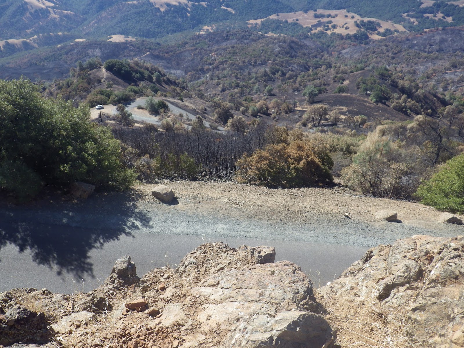
Looking out on the right hand side of the road, you can see Devil's Elbow in the upper left corner, that bump of rock sticking out.
And there's the view of the Summit with Devil's Elbow on the right.
I pulled off the road here to make sure North Peak and Summit trails were open and they were. The plastic signs were just a bit melted at the bottom, while many of the wood posts marking trails were just gone. This one is still standing, but I think one good wind and it'll be a gonner.
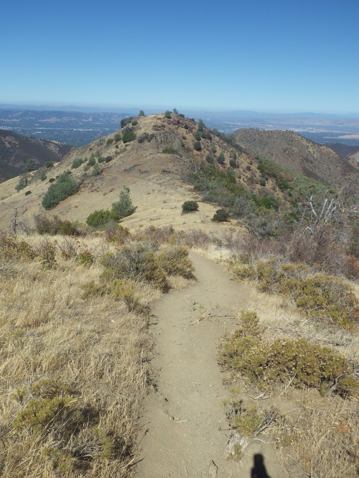
That trail is North Peak Trail. I parked up at the summit and then ran back down to it.
This is the bathrooms at the summit. The fire did indeed burn right up to the buildings...I am so glad they are made of stone and not wood!
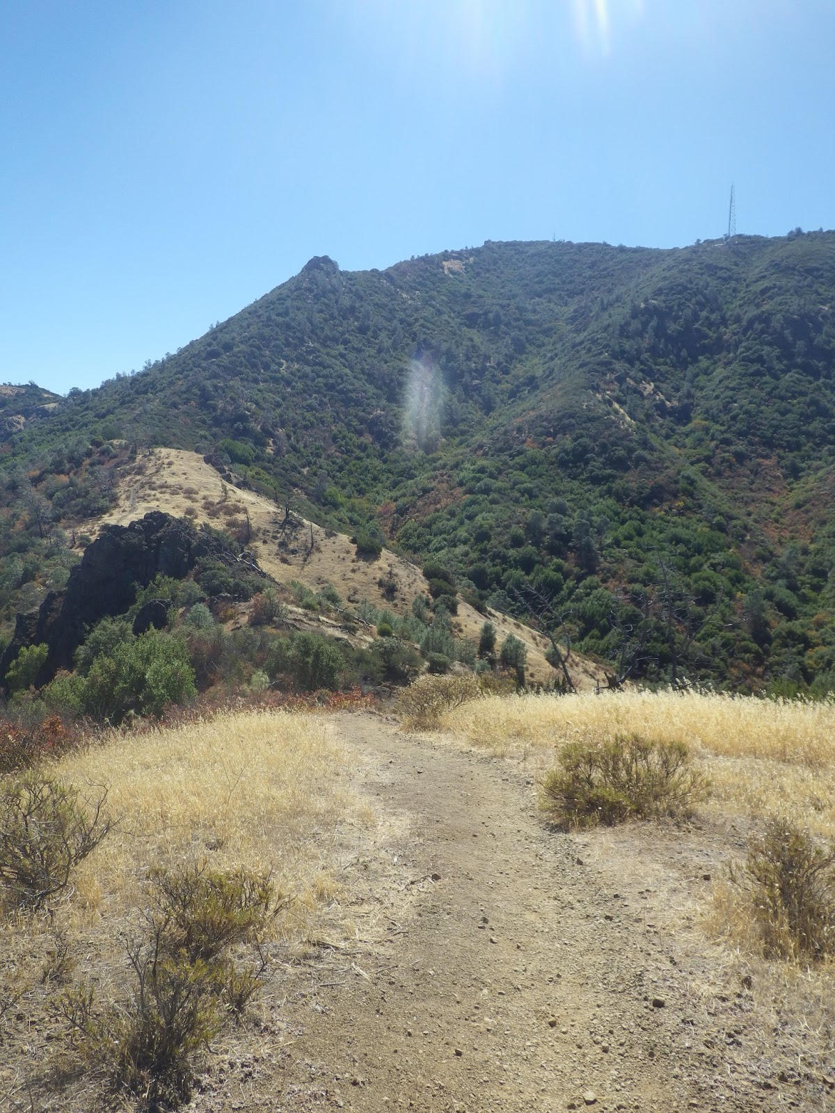
And there's North Peak. Completely burned on one side and a bit over the top.
Lots of these on the mountain.
Heading out on Summit trail, right away I came across some manzanita bushes in the trail. There was a lot of debris, branches, boulders, etc in the trail.
A dozer working on the trail down below me.
Summit Trail is burned on both sides, almost all the way to North Peak.
Tree down. Went over it but it wasn't pretty!
This was where Prospector's Gap and North Peak meet, it pointed up the trail to the top of North Peak.
That's North Peak trail up North Peak. It was a good fire break for the majority of it, the fire jumped it towards the top but didn't make it far.
Originally I had thoughts of running down Prospector's Gap, but it was really torn up from the Cats and dozers. It's full of mogul size bumps, deep tracks, and is really deep, loose dirt. Prospector's Gap is not in an area that burned...meaning no terrain on either side burned, they just used it to bring up equipment.
So instead, I headed down a single track trail called Bald Ridge Trail. It's fun! And this is another area that did not burn, so I got a break from the stinch.
That's me having fun.
That's the trail. There were a few fun rocky sections. It's a really nice trail, fun, shaded, a bit technical, runnable in both directions. I went out it and then turned around and headed back to the summit.
I went to the top of the grassy hill that you see. If you stay on this trail, it goes up Eagle Peak.
Looking back the direction I came from, and would head back.
That's the front side, the unburned side, of North Peak...the side we see from our house.
Looking at where my car is, up at the summit. Time to turn around.
This was my first run in my new Brooks Cascadia's and I really like them!
Heading back, there was something big and slow moving in the bushes, totally freaked me out and I don't scare easy. I threw rocks into the bushes so it would know there was something big and not to come my way, then carried 3 big rocks for a while, then shoved one into my vest just in case.
Solo female runner was not ok with coming up off the trail to find a bunch of inmates standing around. If you can't quite see it, it says Prisoner on their backs.
They are working though, so that's good I guess.
Lot's of rigs around.
That's Muir Picnic area. Was Muir Picnic area.

So there you have it. My thoughts are.....a jumble. It's obvious at every turn how hard everyone is still working, how hard they worked to hold the fire line....how close the summit came to burning, although with stone buildings, I'm not sure if it would have. It's amazing to see all the fire breaks that were just dozed across the land.....I know they are already being replanted, and I know they worked and stopped the fire and so I'm grateful for them, but man are they an ugly scar. The fire was bad, but it could have been much worse. If you are able to get up on the mountain, you will see how hard the fire fighters worked. A few words of warning, there are a lot of crews up there still, lots of vehicle traffic from the different agencies up there still working. Also, the bathrooms at the summit are closed due to damage, so if you really have to go like I did, you have to go down to the lower parking lot where the construction crews have an outhouse and use it. Also, there's loose gravel on the road, so take the corners slower than usual, especially if you are a cyclist. The Cats have also chunged up the roadway with tracks in quite a few places.
It felt good to be on the mountain!


This is a great picture post of the area - thanks for putting it together! You've probably heard, but Coastal has rescheduled their Diablo run for Oct 5 (a Saturday!). Diane won't be able to go, but I'm planning to do the Half. (Although I'm sorely tempted to try the Full. We'll see and it might depend on the weather.)
ReplyDelete